OUR SERVICE
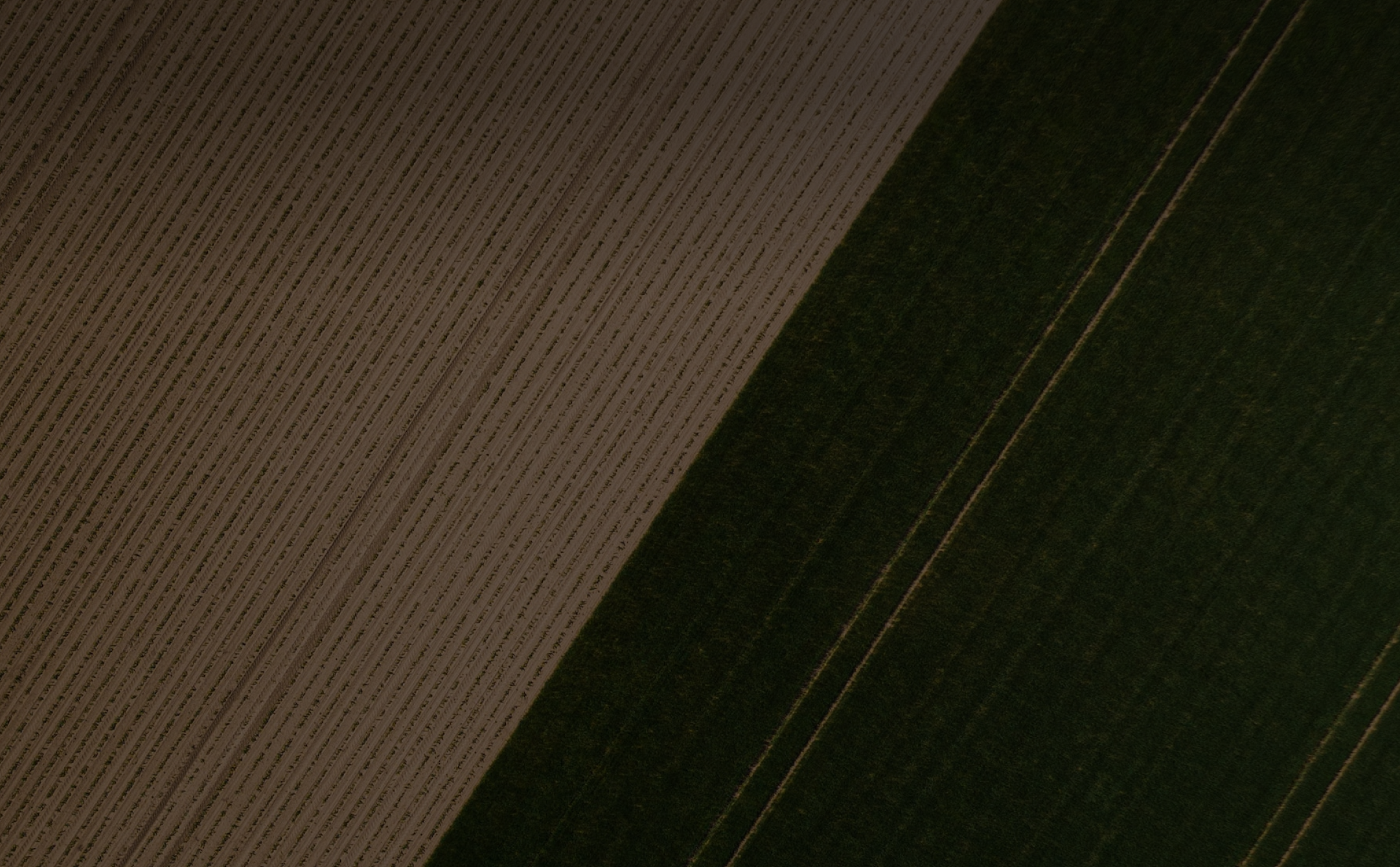
Agriculture
We can detect which plants are growing or can be grown in a specific field as well as measuring water availability, nutrients, texture and soil.


AGRICULTURE
Agriculture Process
Empowering Sustainable Farming with AI-Driven Soil Analysis and Carbon Capture
Soil Analysis
Water Analysis
Irrigation Optimization
Fertilizer Optimization
Crop Health Monitoring
Basic Analysis Satellite


OUR PRODUCT
Soil Analysis
Cybertiks Soil Analysis, a revolutionary service employing satellite and AI technologies, offers you an exhaustive evaluation of soil health, tailored to comply with agricultural requirements across European, North American, and regional standards. Leveraging the capabilities of Remote Sensing, we analyze 100% of the soil information in an area, a significant improvement over traditional methods that only evaluate physical samples in a lab.
Our approach, integral to Precision Agriculture and E-agriculture, promotes time efficiency, cost-effectiveness, and can be conveniently managed via a dedicated app. With each satellite data set received, we calculate an average measure for each acre, serving as the baseline for the area and supporting informed decision-making for Sustainable Agriculture.
In line with our commitment to supporting Carbon Farming and carbon capture initiatives, we provide our clients with a CSV file detailing the analysis of each acre. Additionally, we compile a PDF outlining average measurements per acre for each piece of land, allowing for efficient Carbon Credits allocation and comprehensive Agricultural Analysis. Experience the future of agtech with Cybertiks' Soil Analysis, advancing the journey towards a more sustainable and carbon-neutral agriculture industry.
ANALYSIS
Deliverable
We analyzed 100% of the area with a resolution of 1 feet2 and a depth of 12 inches. The deliverable includes:

1 CSV file with the metrics analyzed, we do an average for each Acre at 12 inches deep.

A polygon that identifies the location of each acre

1 average for every 40 Acres in case they do not require the detail.

A pdf with the average measurement for each X section totaling X acres.

Section
British
Metric

1
1/2
1/4
640 Acres
320 Acres
160 Acres
x Acres
2.845041 km2
1.29504 km2
0.667755 km2
X km2
OUR PRODUCT
Remote Sensor
Soil Analysis offers you an integrated review and evaluation of soil with the help of our satellite and Artificial Intelligence technologies.
Cybertiks Soil Analysis measures nutrients and soil texture according to the European community, North America, and regional agricultural requirements. Our satellite analyzes 100% of soil information in an area, whereas traditional methods only analyze a physical sample that must be sent to a lab. Our method can be done via an app and it is more cost and time efficient. After the satellite data is received, we calculate an average measure for each acre as the baseline for the area.
Our client receives a CSV file outlining the contents and analysis of each acre, as well as a PDF compiling the average measurements of one data point per acre for each piece of land.
Soil Sensor BrioAgroRemote Physical Sensor
Soil Moisture
Meteorologic Measures Every 15 min
Ambient Temperature
Relative Humidity
Rain Forecast
Wind Speed and Direction
Hours of Sun
Cloudiness
Harvesting Time
(m3/m3)
-
-
-
-
-
-
%
-
OUR PRODUCT
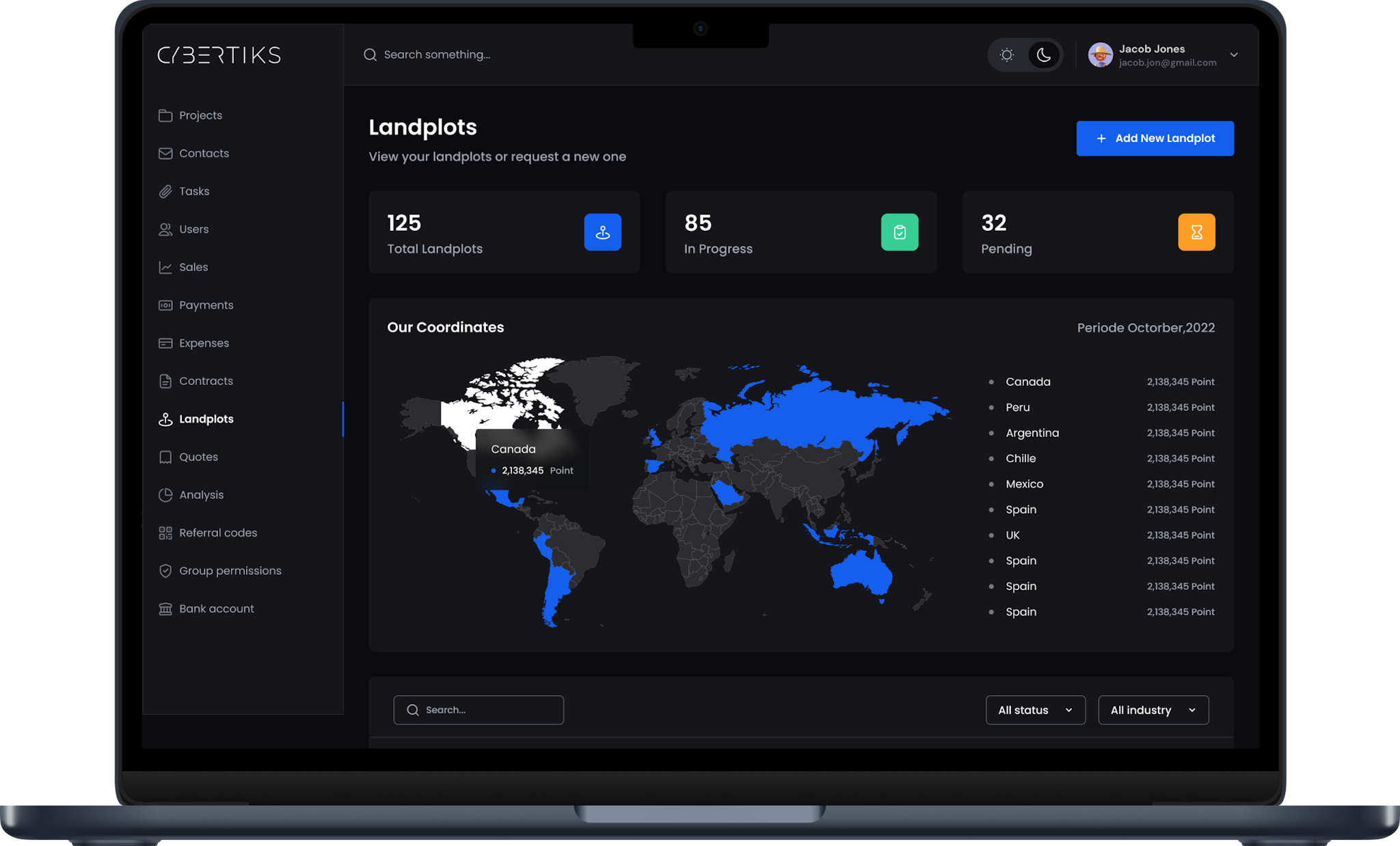
Platform Saas
Out platform is designed in an easy to use interface, that allows you to request fields for agriculture.
With our platform you can monitor your recent projects, view field results and even pay in the same platform. To start using our platform you just need to register at https://cybertiks.com/signup.

CYBERTIKS
Comparison
The table below is a comparison of traditional and cybertick usage


There is no geographical limitation
There is no access limitation
No permission or physical visit required
Traditional
Permission is required
Complicates accessibility for some people
Limited by areas
If using a drone or plane, permission is required