✨ Get Started
Monitor your agriculture field via satellite
We offer valuable insights like nutrients and texture for the soil of your fields all via satellite using advanced AI models.
Services
Harnessing the power of satellite imagery
At Cybertiks we specialize in delivering bespoke solutions designed to meet the pressing needs of diverse industries worldwide. Our key area of expertise lies in remote sensing of industrial requirements, achieved by harnessing the power of satellite imagery and the integration of accurate AI models trained on thousands of fields.
Here's how it works
Get the most out of your fields
With Cybertiks you can now analyze any field in the world remotely and get those metrics you need the most. Our AI models are tailored for each metric and have gone through testing and validation offering over 80% accuracy
Create New Fields
Enter your field's coordinates by drawing its outline.
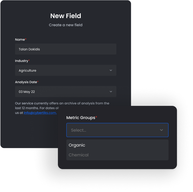
See historical insights
View historical metrics for your field thanks to the satellite's historical archive.
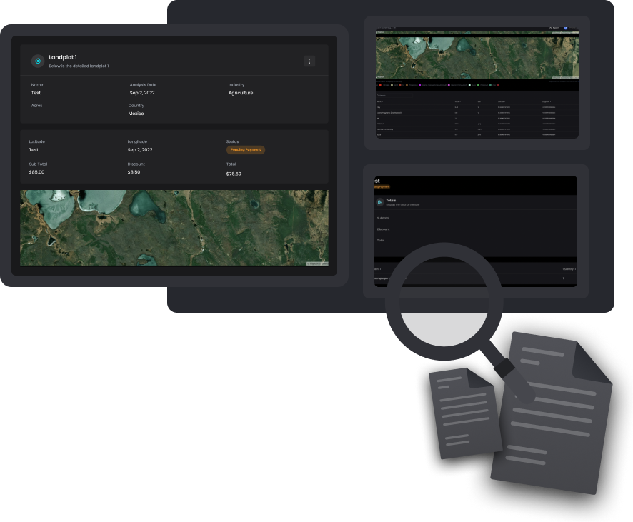
Monitor your field's status
Monitor your field status for analysis changes. We provide new results every 7 days
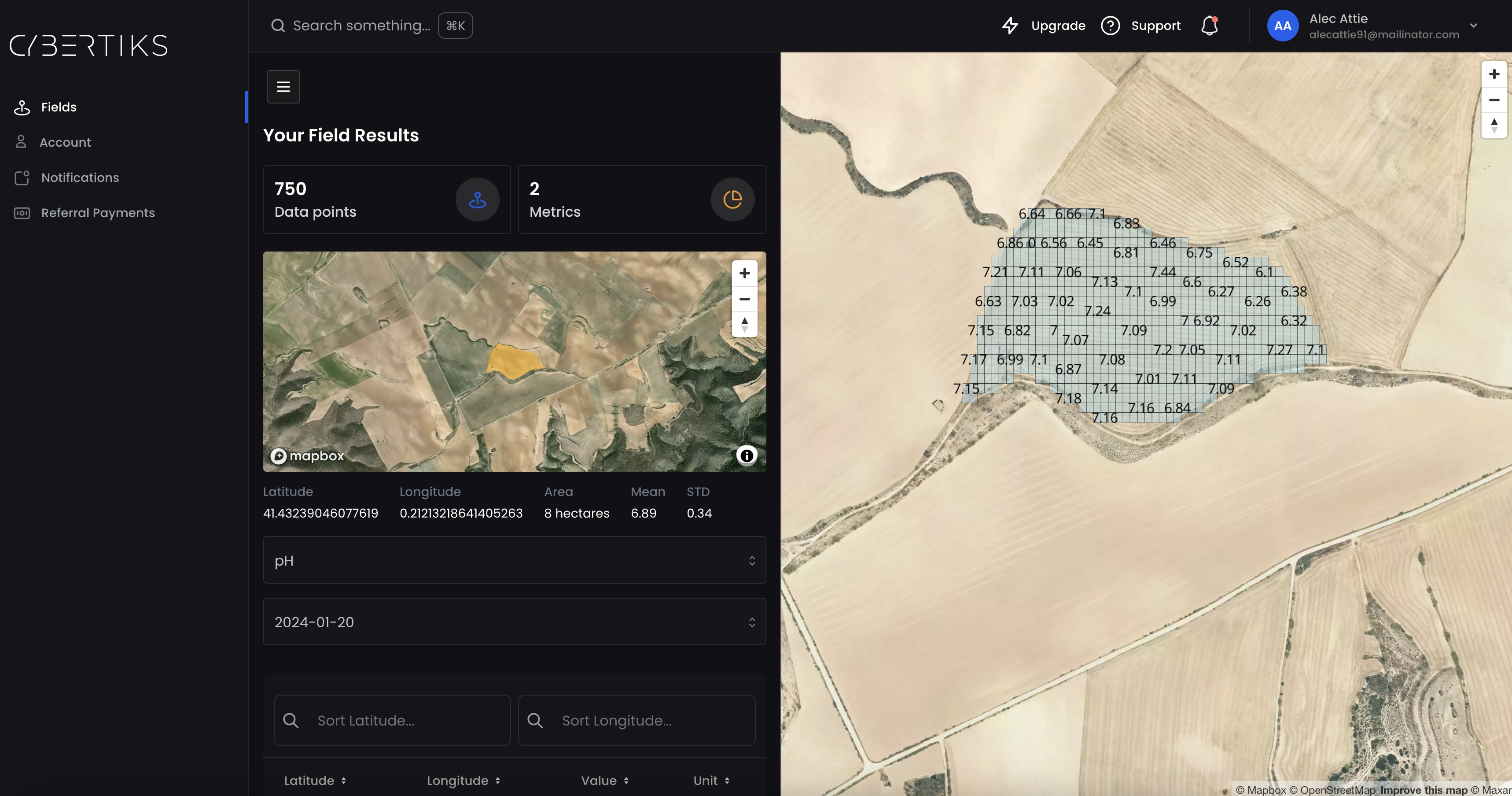
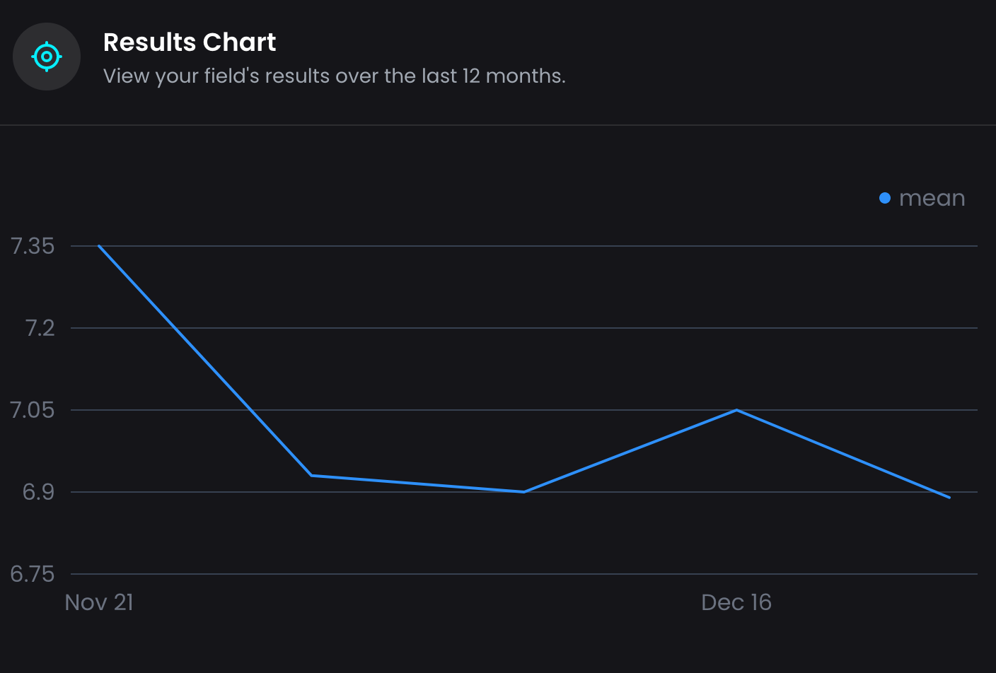
View and visualize your results
View your analysis results on the map with a resolution up to 100m2
Behind the scenes
Sensor Fusion
We integrate many sources of information behind the scenes to give you a complete and strategic vision.


Certifications
We always start with verified validations from industrial organizations

Synchronize Data
We detect and synchronize data from different detection sensors.

Data Integration
We integrate optical, radar and any data available..

Deliverable
We present data in a convenient way for our clients.
How does it work?
Let's introduce you to QSIS
By using thermodynamic information captured by electromagnetic sensors located in space satellites, weather balloons, drones, cameras and radars we identify, classify and quantify the presence of materials with quantum-enabled artificial intelligence for scale and speed.
Learn More ![]()


Tailored Solutions
We design the best-fitting integrated solution for each field and client.

Detection
We are able to detect any mineral or element with a recorded spectrographic fingerprint.
Classification
We classify elements according to their spectral signature, shape or category selected by the client.

Quantification
Depending on the element, we are able to provide a specific amount or a conditional range.
Services
This is how we can help
Our strategic model and expert knowledge allow us to provide tailored solutions for each of our clients.


QSIS
We use thermodynamic information captured by electromagnetic sensors to classify and quantify the presence of natural resources, elements and minerals.

Artificial Intelligence
We can analyze, identify, measure and correlate data to generate the necessary reports and information using artificial intelligence (AI).

Software Development
We build custom SaaS applying our knowledge after years of experience in frontend and backend architectures and implementations.
With years of experience
Empowering Great Companies
We have everything you need to innovate.
30+
Projects Completed
100%
Return on investment
80%
AI model accuracy
10
Years of experience